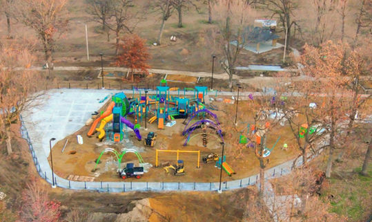
Precision Mapping and Surveying for Construction Sites

Accurate site mapping and surveying are critical for successful construction projects. Our cutting-edge drone technology and high-resolution imaging provide precise, real-time mapping and surveying data to support decision-making and streamline project execution. With our services, construction teams can ensure that their projects are built on accurate, up-to-date site information, minimizing errors, delays, and rework.
Precision Mapping and Surveying for Construction Sites
Key Benefits of Drone Mapping and Surveying:
-
Accurate Site Mapping: Using drones equipped with high-resolution cameras and advanced GPS, we can create highly detailed, accurate maps of your construction site. These maps provide topographic data, boundary lines, and other key site features, enabling project managers to visualize the entire area with precision.
-
3D Modeling and Digital Terrain Models (DTM): By capturing data from multiple angles, we generate 3D models and digital terrain models that represent the site’s surface, including elevations, slopes, and structures. These models provide an in-depth understanding of the land and can be used for planning and design purposes.
-
Real-Time Surveys: Our drone-assisted surveys allow for real-time data capture, reducing the time needed for traditional surveying methods. This allows construction teams to begin work immediately with the most accurate, up-to-date information available.
-
Volume Calculations and Material Estimates: Drone mapping enables accurate volume calculations for earthworks, stockpiles, and materials. This data helps project managers make informed decisions regarding material usage and storage, ensuring that resources are allocated effectively and reducing waste.
-
Site Progress Monitoring: With regular mapping and surveying, you can track how the construction site evolves over time. Our drone technology provides comparative views of past and present site conditions, highlighting changes in elevation, material stockpiles, and other important features. This ongoing monitoring helps identify potential issues before they affect project timelines.


