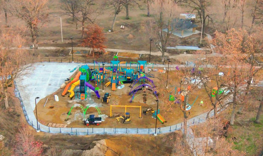
Precision Mapping and Surveying for Construction Sites

Accurate site mapping and surveying are critical for successful construction projects. Our cutting-edge drone technology and high-resolution imaging provide precise, real-time mapping and surveying data to support decision-making and streamline project execution. With our services, construction teams can ensure that their projects are built on accurate, up-to-date site information, minimizing errors, delays, and rework.
Precision Mapping and Surveying for Construction Sites
How Drone Mapping Enhances Construction Projects:
-
Improved Accuracy: Drone technology provides more accurate and detailed site data than traditional methods, which reduces the risk of mistakes and discrepancies in construction planning. With highly accurate maps and 3D models, you can trust that the foundation for your project is built on solid data.
-
Faster Data Collection: Traditional site surveying can take days or even weeks to complete. Our drone mapping process is much quicker, saving time and allowing construction teams to proceed with their work faster.
-
Cost Savings: By reducing the need for manual surveying and lowering the risk of errors, drone-based mapping and surveying services can significantly reduce overall project costs. The data gathered can be used throughout the entire project lifecycle, from planning to completion.
-
Safer Inspections: Drones allow us to map and survey areas that would otherwise be difficult, dangerous, or costly to access. This eliminates the need for crews to physically navigate hazardous or hard-to-reach locations, reducing the potential for accidents.
-
Streamlined Collaboration: Our detailed maps and 3D models can be shared with all project stakeholders, ensuring everyone—from architects to contractors to project managers—is on the same page. This level of transparency and collaboration helps keep the project on track and reduces miscommunication.
Applications for Construction Site Mapping and Surveying:
-
Pre-Construction Planning: Accurate site mapping provides critical insights for architects, engineers, and planners before construction begins. It allows for a better understanding of the land and topography, supporting more precise designs and plans.
-
Earthworks and Excavation: Our drone data can be used to map out excavation zones and track the progress of earthmoving operations. You’ll have up-to-date volume calculations for stockpiles and earthworks, helping to manage materials more effectively.
-
Regulatory Compliance: Many construction projects require specific surveys and land assessments for regulatory compliance. Our drone mapping services help ensure that your project adheres to local regulations and zoning laws, avoiding costly fines and delays.
-
Ongoing Site Monitoring: Regular drone surveys allow you to keep track of the site’s progress throughout the project. You’ll be able to monitor structural developments, material usage, and overall progress from start to finish, helping ensure that the project stays on schedule.
Why Choose Our Drone Mapping and Surveying Services?
-
Enhanced Precision: Our drones collect highly accurate data, ensuring your project is based on the most reliable information available. This eliminates the risks associated with manual measurements and outdated site surveys.
-
Quick Turnaround: With drones, we can provide rapid mapping and surveying services, enabling you to keep the project moving forward without delay.
-
Comprehensive Data: From 3D models to volume calculations, we deliver all the data you need to manage your construction project efficiently. This comprehensive data gives you the power to make informed decisions at every stage.
-
Increased Efficiency: Drones allow for faster, safer, and more cost-effective site surveying, enabling you to stay on top of every aspect of the project without the need for extensive manual labor.


